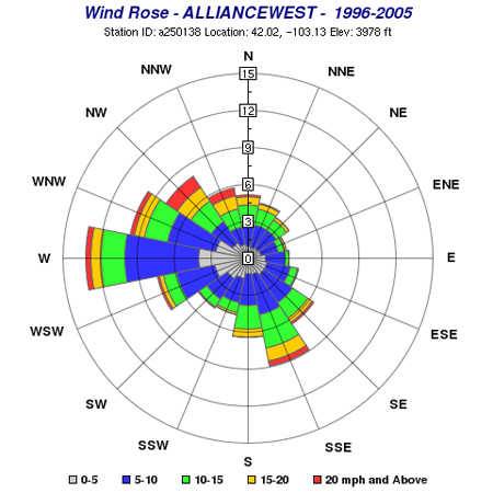
A Wind Rose is a type of circular plot that exhibits the prevalence of wind directions at a given location. The Wind Rose displayed above was generated from data collected at a station in Alliance, Nebraska from 1996-2005. The wind speed ranges from 0 mph to above 20 mph from 0% - 15% of the time. In this example the strongest winds occurred in the west blowing at a rate of 20 plus mph for about 13% of the time. This type of graph can be very useful in determining typical wind speed and direction for a location.
No comments:
Post a Comment